Posts

Showing posts from May, 2017

Santiago 1522 - 2016
Image
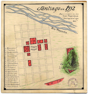
Map of Santiago de Chile 1552 showingthe Mapocho River and the historic centre. Base Plan for an urban design competition for Explanda de los Mercados 2015 showing the canalized Mapocho River  In 2015, a public competition called Explanada de los Mercados (the market esplanade) was announced to redesign the area that spanned both sides of the Mapocho River in central Santiago.  This is the area where the canalised Mapocho has it's worst contemporary reputation as a place of disease, death and dirt.  The competition was to create a design solution that would connect both sides of the Mapocho River and generate a type of culinary tourist precinct. The site included the fish and produce markets, a heritage walk of iconic colonial churches, the former train station now exhibition space Estacion Mapocho, a major metro station, bus interchange and collecive taxi terminal. Another interesting aspect of this competition was that it was obligatory to use the rem...
La entrada urbana

Image
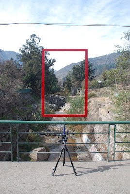
La entrada urbana was the first intervention in the Mapocho River that was undertaken as part of this investigation. After reading Mapocho Torrent Urbano and the chapter by Mario Perez de Acre, that inspired the Mapocho 42K project and which described the point at which the Mapocho River enters the metropolitan area of Santiago, I thought that I should visit this place. It is a bridge in the municality of lo Barnechea. Of the bridge's design and structure, it is nondescript, in fact, it is simply perfunctory, not in the modernist sense but in the sense that it has no relationship to the design of a bridge as establishing a relationship through the fourfold elements ( earth, sky, mortals and divinities)  of which Heidegger spoke. The mains water pipes that it covers or carries are more pronounced for the pedestrian and are not a deliberate design element (a la Pompidou Centre) and, as you will note in the image here, electrical cables hang as ...