Posts

Showing posts from June, 2017

Visita río Mapocho

Image
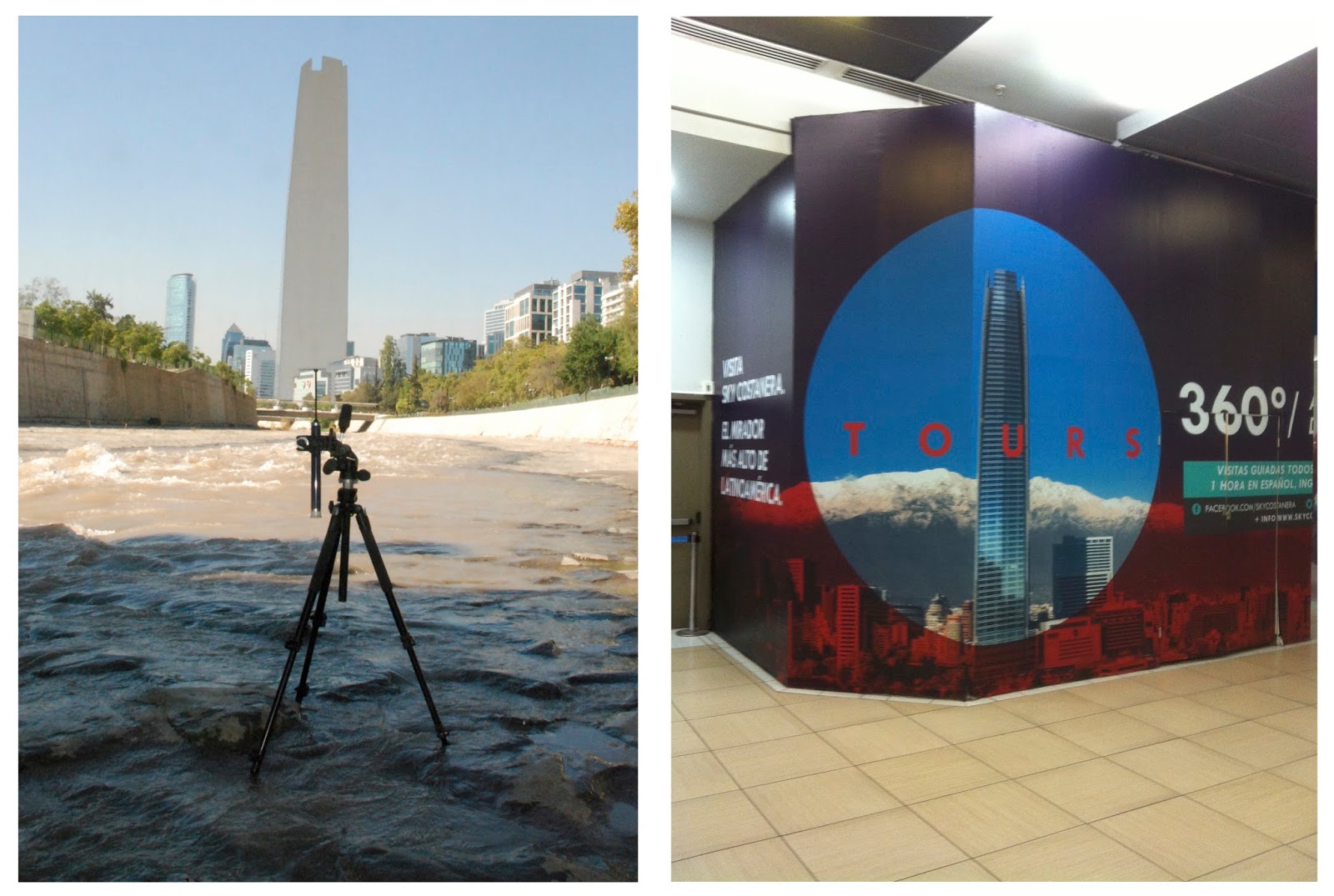
A walk in the causeway of the Mapocho River was offered as part of the extension program for the exhibition Orillas, Puentes y el Torrente. This walk was planned to enter the causeway from the only entrance that is accessible 24/7 365 days of the year. In this sense it is the only point at which the Mapocho River as such becomes a public space. However, on the same day, that was planned three months earlier, the body of a murdered woman was found just 100 metres from the entrance point and the police used this to enter the crime scene. Our walk continued in the opposite direction towards where the Canal San Carlos enters the Mapocho River. Canal San Carlos was an earlier canalisation project that supplied sufficient water for the growing cities needs. In combination with the canalisation of the Mapocho it turns the flow into a mostly muddy torrent.

Respirando el río (2016)

Image
This is a video on continuous loop of an inflatable swimming buoy being inflated and deflated by breathe. Depending on when the viewer begins to watch the video it is difficult to tell if I am taking air in order to breath and live or giving air into the membrane to use it as a life saving device. In the end it is obvious that I am doing both, or is it? The sound in this video is important as well. The video is actually the buoy being inflated and then this footage is reversed to deflate it - the sound is reversed as well. The type of sound created when the person is taking air from the buoy is disturbing. The sound in this video is important as well. The video is actually the buoy being inflated and then this footage is reversed to deflate it - the sound is reversed as well. In the gallery, this awkward breathing was the background sound to the progressive drawing Abajo los puentes yo vivo río Mapocho. These two works  were positioned diagonally opposite in the gallery and curved sur

Photoshopping

Image
Visita río Mapocho. Publicity for a public walk in the Mapocho River that contains an image of an intervention in the same called Photoshopping . Both concern the image of the city and the city as image. A 360 degree aerial view of the city can be taken from the observation deck of Costanera Center, the new icon of Santiago (image right). The intervention and the walk seek to annul this image and reinstate the original icon of the Mapocho River through its 180 degree line between the Cordillera and the sea still present in the absence of its canalization (image left).

Vista del Valle del Mapocho. Sacada del Cerro Santa Lucía.1843-2016

Image
There are five images that share the same view of the Mapocho Valley looking eastward towards the Cordillera from Cerro Santa Lucía  - the hill made into a vertically spiralling public park by  Benjamín Vicuña   Mackenna in the late 19th Century. Cerro Santa Lucía has become one of the four icons of Santiago in landscape painting of the late 19th and early 20th centuries.  The created image here is a collage of a reproduction of the lithograph created from drawings by M. Rugendas and C. Gay and printed by F.H. Lehnert for the Atlas of the Physical and Political History of Chile in 1854 and a photograph taken by me from the same point of view in 2016. The Atlas was produced in two version, one in black and white and the second in colour. In my photograph, you can no longer see the path of the Mapocho River but you can see two built icons that have replaced it - the brown building in the mid ground is Diego Portales that forms part of the San Borja housing development of the 1960

Bajo de los puentes yo vivo Mapocho

Image
Dibujo en vivo encima papel curvado. Dibujo final es acerca los dibujos de los ingenieros de las estructuras improvisadas de ellos sin hogar quien viven en los orillas efímeras del rio Mapocho. El dibujo fue hecho durante la exposición  Una adicción al dibujo fue dando  cada semana cuando la galería esta abierto.

Calicantocarros

Image
Dentro de la exposición Orillas,  Puentes y el Torrente  he desarrollado una propuesta para una intervención para un puente del río Mapocho. Esta intervención se llama CaliCantoCarros y se refiere a los dos puentes que, de dos maneras diferentes, y a no existen. El primer puente - Cal i Canto - fue destruido en 1888 (dos postales abajo) por lo que algunos sostienen era una combinación de inundaciones y corrupción durante la época de la canalización del río Mapocho. El segundo puente tampoco existe en su forma pre-canalizada, sino que mantiene un vínculo histórico en el mismo lugar y con el mismo uso pero su estructura es metálica (imagen a la izquierda y mas abajo). Todavía, el puente Los Carros cruza ambos lados del Mapocho y conecta sus mercados - Mercado Central y La Vega. Para investigar los conceptos metafóricos y físicos sobre los puentes del Mapocho como conexiones de la sociedad y la ciudad, el ambiente urbano y natural, estoy empezando con una fotografía del siglo XIX (ima